Search
262 SUBMISSIONS 160 CITIES 54 COUNTRIES 6 LANGUAGES
Flourish Map
https://public.flourish.studio/visualisation/4663664?361357/embed
Tag Link
Flourish Source
visualisation/4663664?361357
Location
Rosario, Argentina
THE PROBLEM
Rising temperatures and flooding are compounding the lingering damage of the 2001 Argentinian economic crisis to exacerbate urban inequality.
The Big Idea
Evolve city’s flagship urban agriculture program into a cornerstone of inclusive climate adaptation through repurposing under-utilized public land.
Life Changing Impact
Provides healthy local produce, livelihoods for low-income families and remediates public lands, while reducing emissions and increasing resilience to floods and extreme heat.
Ripple Effect
Sparked a citywide remediation of vacant land for sustainable and healthy food production and increased climate resilience while expanding to include peri-urban areas.
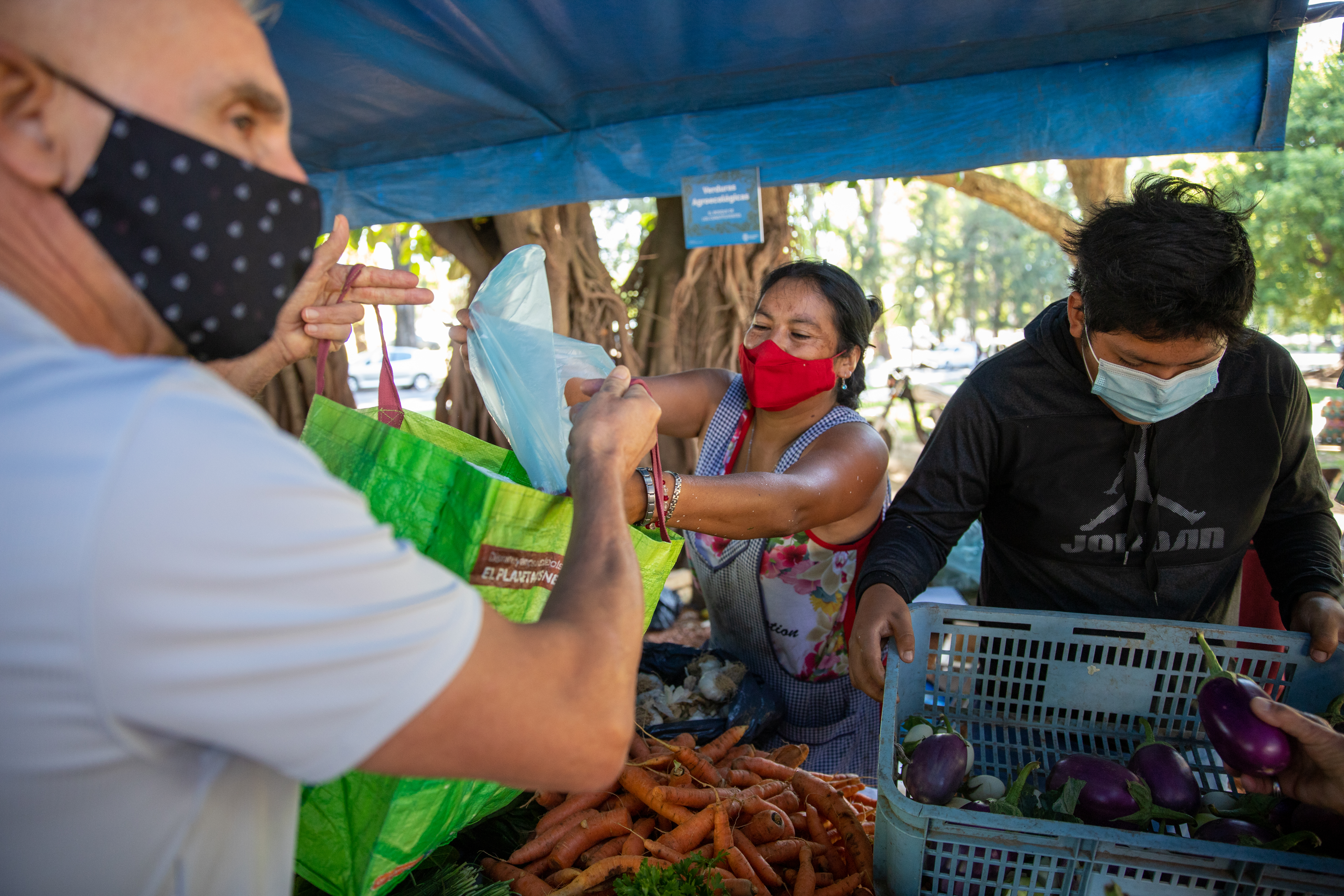
Initially launched in the wake of the Argentinian economic crisis of 2001, Rosario’s flagship urban and peri-urban agriculture program has evolved to become a cornerstone of the city’s response to increased flooding and heat events. The program, designed to help improve food security and nutrition for low-income residents by strategically repurposing public land and private peri-urban spaces, now helps improve resilience to extreme events and reduce carbon emissions via more compact food supply chains.
The collapse of the Argentinian economy in 2001 sent Rosario, the country’s third-largest city, into a rapid downward spiral. With more than half of Rosario’s population below the poverty line and a quarter of its workforce unemployed, desperation even led some to start looting supermarkets. To aid those hit hardest, the municipality launched an urban agriculture program in partnership with a local NGO, the Center for the Study of Agroecological Production (CEPAR), and the national Pro Huerta program for family gardens.
Demand for fresh produce was high that the city quickly opened a new market to enable growers to sell fruits and vegetables directly and provide new sources of affordable and healthy local produce to residents.
As the economic crisis stabilized, the municipality planned for the future of the urban agriculture program. It began working with UN-Habitat's Urban Management Program and the National University of Rosario on an inventory of vacant and underutilized urban land that could be repurposed into agricultural plots. The inventory found that 36% of the municipal area was suitable for agriculture conversion, including land along railroads and highways, low-lying, flood-prone lands, and designated greenbelts. In 2004, the mayor approved a municipal ordinance allowing the city to grant temporary tenure of vacant land to the urban poor for urban agriculture.
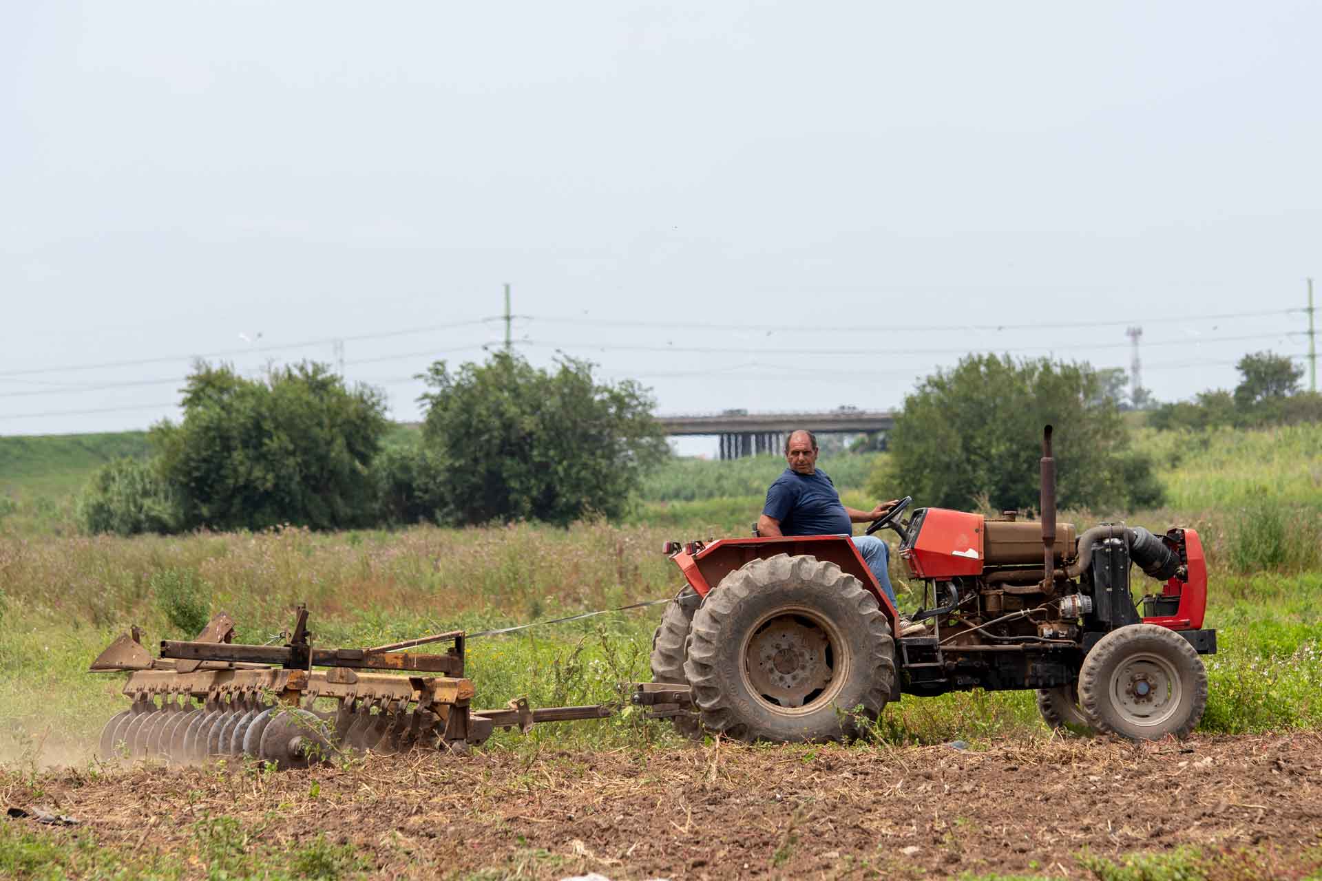
While the program helped reduce food insecurity and alleviate poverty, extreme flooding brought a new crisis threatening lives and livelihoods in Rosario. Over the course of five days in 2007, record-shattering rainfall forced the city to evacuate over 3,000 people. Recognizing that the flooding would only worsen with climate change, the Department of Water Management created a flood risk map to identify problematic zones of the city and inform development priorities in the Urban Plan of Rosario 2007-2017. The new plan included Parques Huerta (Vegetable Garden Parks), an initiative aimed at converting underutilized land to green spaces to help absorb excess water and prevent floods.
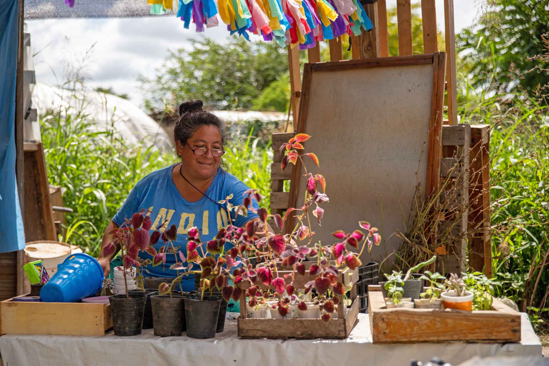
Since the city already had an inventory of available land, it was able to act quickly. In 2007 and 2008, two Vegetable Garden Parks were opened, bolstering the city’s flood resilience while providing additional land for urban agriculture. The public parks also offer a variety of social programs around sustainability, including workshops and tours of the gardens. Urban farmers maintain temporary tenure of the land in exchange for its continued maintenance.
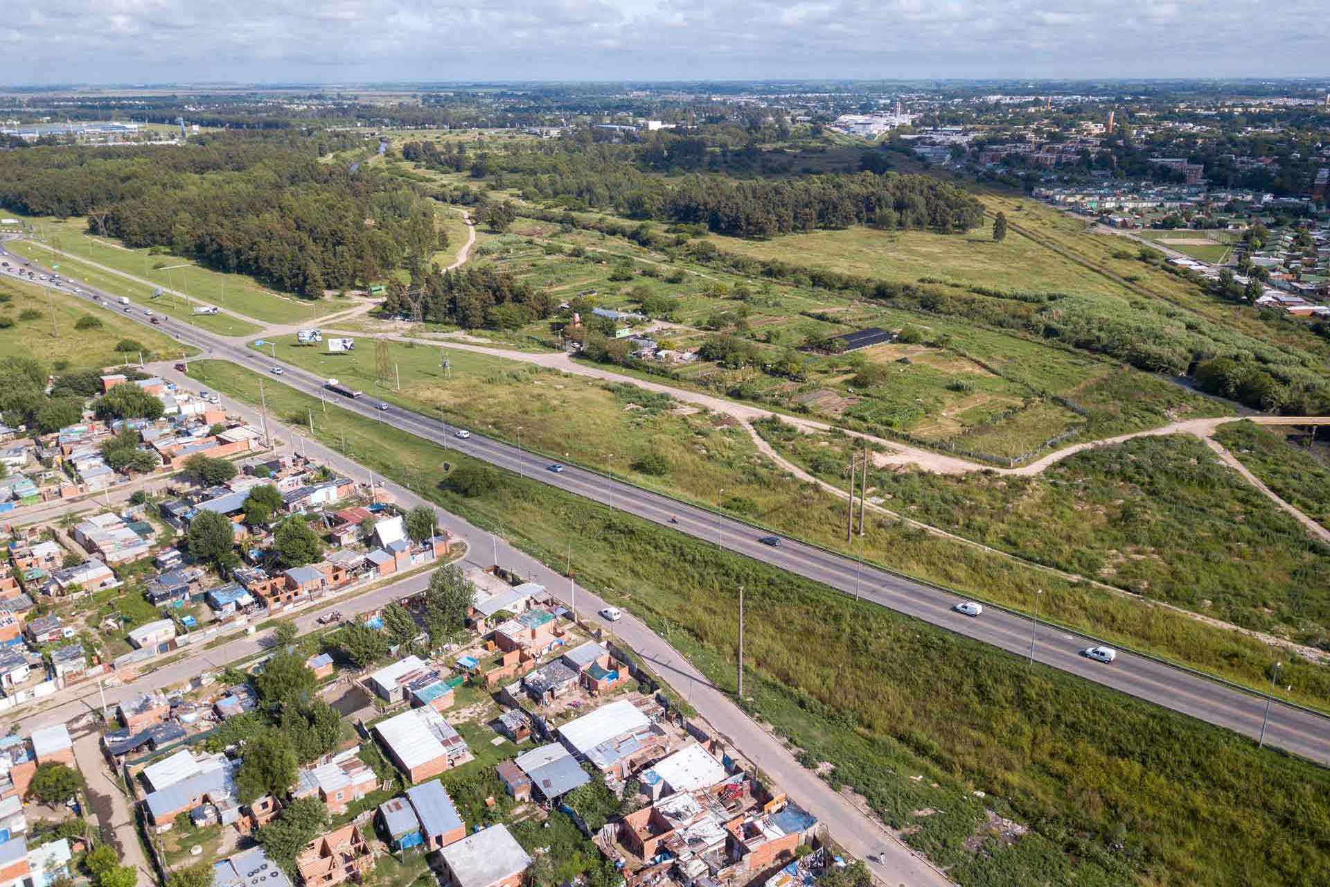
Recognizing that the city’s resilience depends not just on converting land in inner neighborhoods but also on protecting its rapidly urbanizing surroundings, the municipality passed an ordinance in 2011 designating 800 hectares of peri-urban land to be used for agroecological production as well. Formally adopted into the city’s strategic plan and launched in 2015, the Green Belt Project helps contain urban sprawl while restoring land in an ecologically sensitive manner. It also increases Rosario’s resilience to floods and expands the total land available for food production.
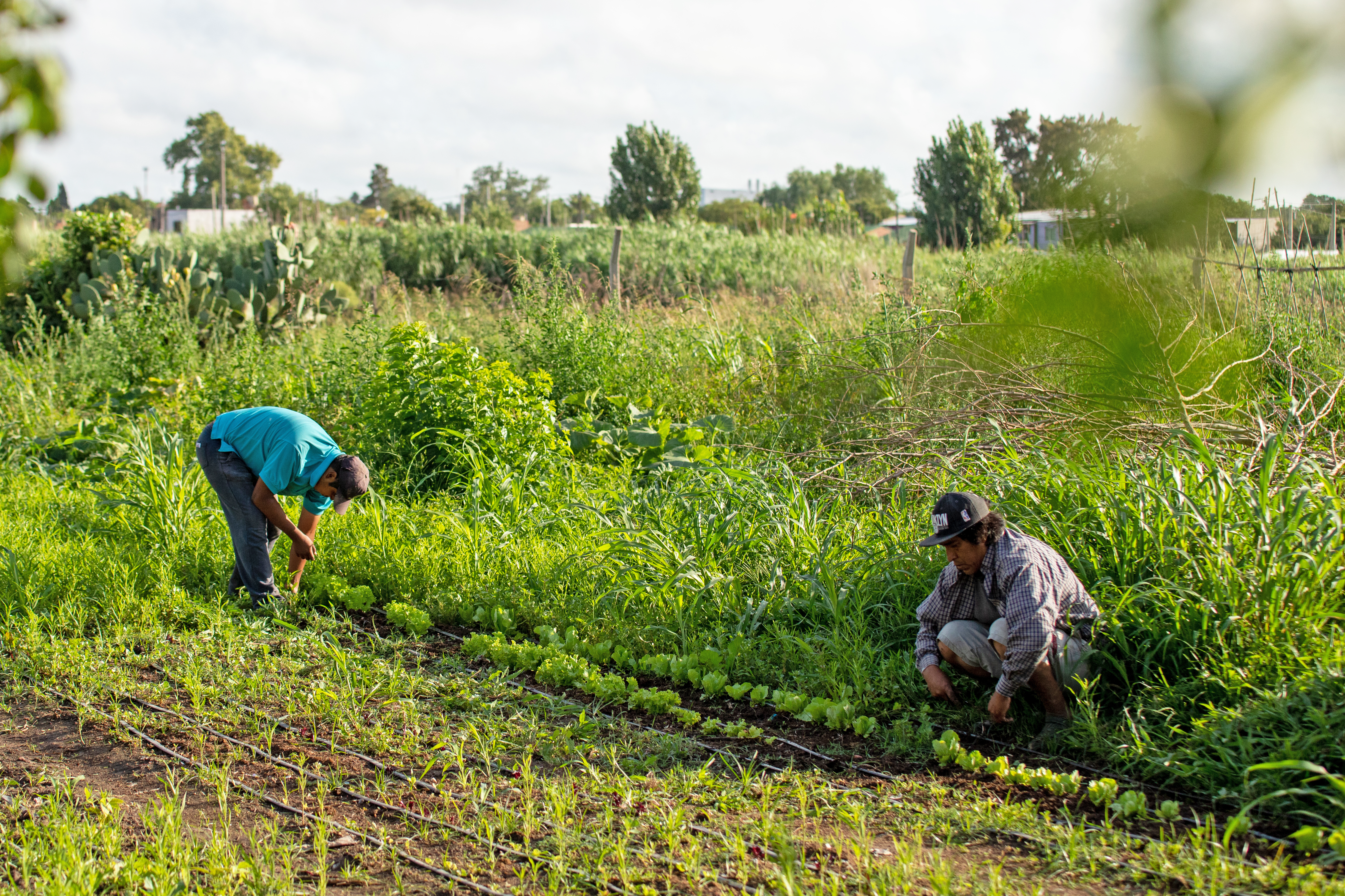
Rosario has continued its commitment to urban agriculture and climate resilience, opening five additional Vegetable Garden Parks, all located in traditionally low-income neighborhoods. The city’s holistic approach has left enduring positive marks on people’s livelihoods and wellbeing, while reducing food import dependency and food insecurity. Greenhouse gas emissions associated with the delivery of vegetables, for example, are estimated to be reduced by as much as 95%. Urban agriculture is still a growing movement across the city. Today, more than 2,400 families have their own gardens and practice environmentally sustainable agriculture.
By The Numbers
75 hectares for agroecological production and urban gardens
800 hectares preserved for agriculture in peri-urban area
2,500 tons of fruits and vegetables produced each year
7 new permanent market spaces created
2,400+ families started their own gardens
95% emissions reduction for locally produced vegetables
2020-2021 SUBMISSIONS
262 SUBMISSIONS 160 CITIES 54 COUNTRIES 6 LANGUAGES
Location
Ahmedabad, India
THE PROBLEM
Rapid urban expansion and increased severe weather events have made slum communities particularly vulnerable to climate change, causing damage, disease and loss of critical livelihoods that disproportionately affect women.
The Big Idea
Empower women to conduct climate risk assessments for water shortages, extreme heat, flash floods and vector-borne diseases through a partnership model that helps them access and implement both technical and non-technical solutions in their communities.
Life Changing Impact
Increased household and community resilience through a range of physical upgrades, increased access to city-level initiatives and decision-making, and improved status of women in community and municipal decision-making processes.
Ripple Effect
Established formal input channels into multiple municipal climate action plans, including those for heat and monsoons, and inspired the creation of similar models in six other cities across South Asia.
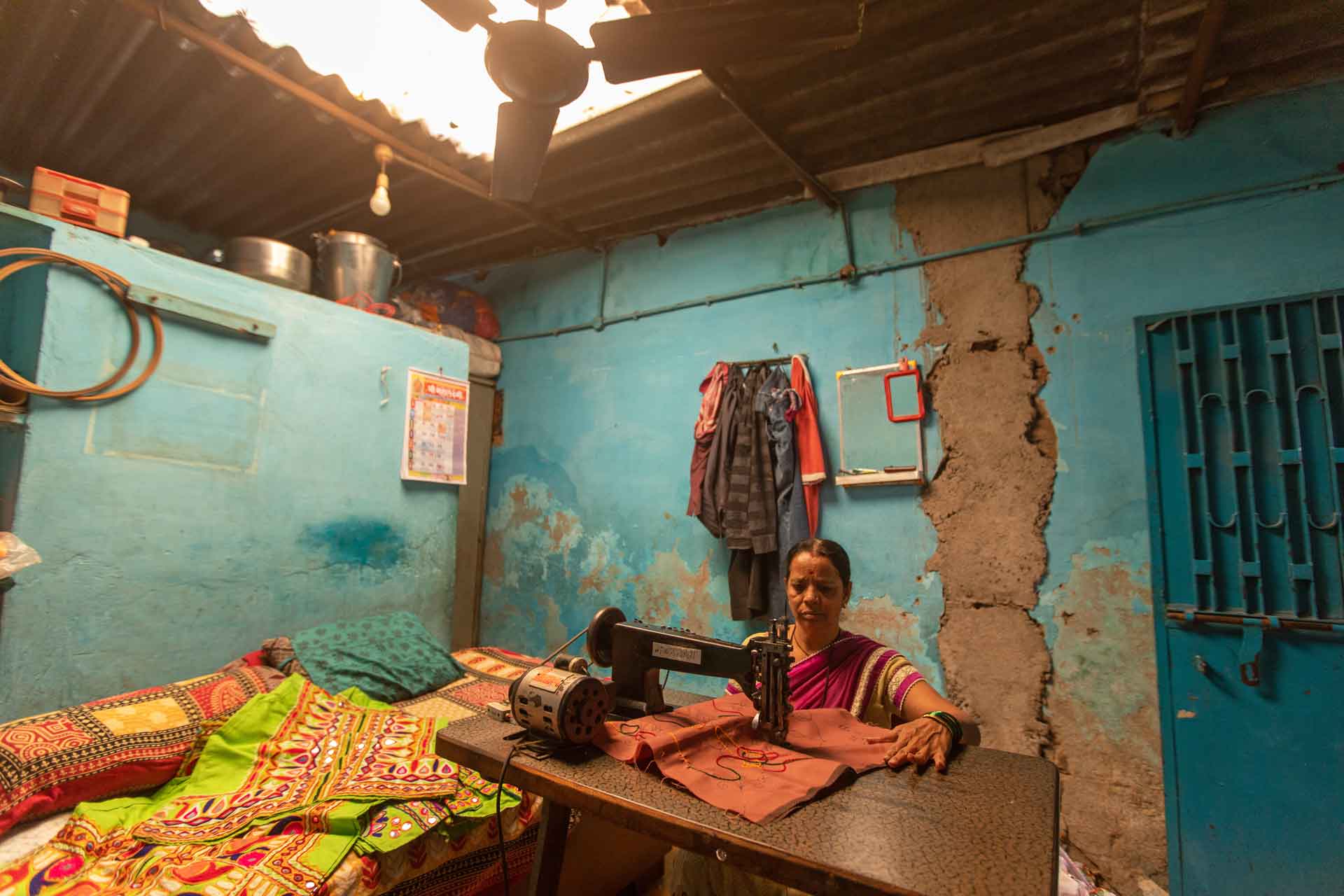
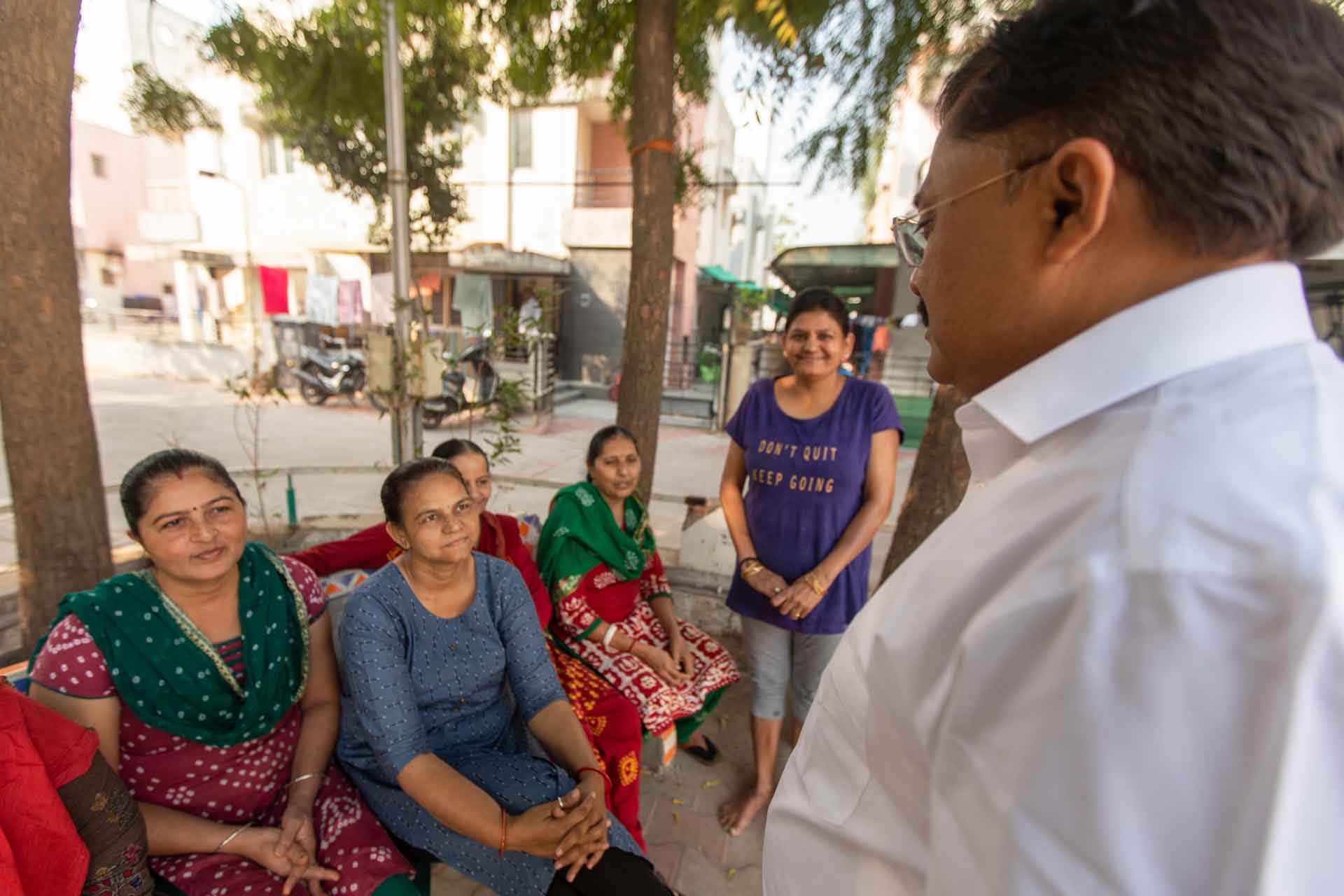
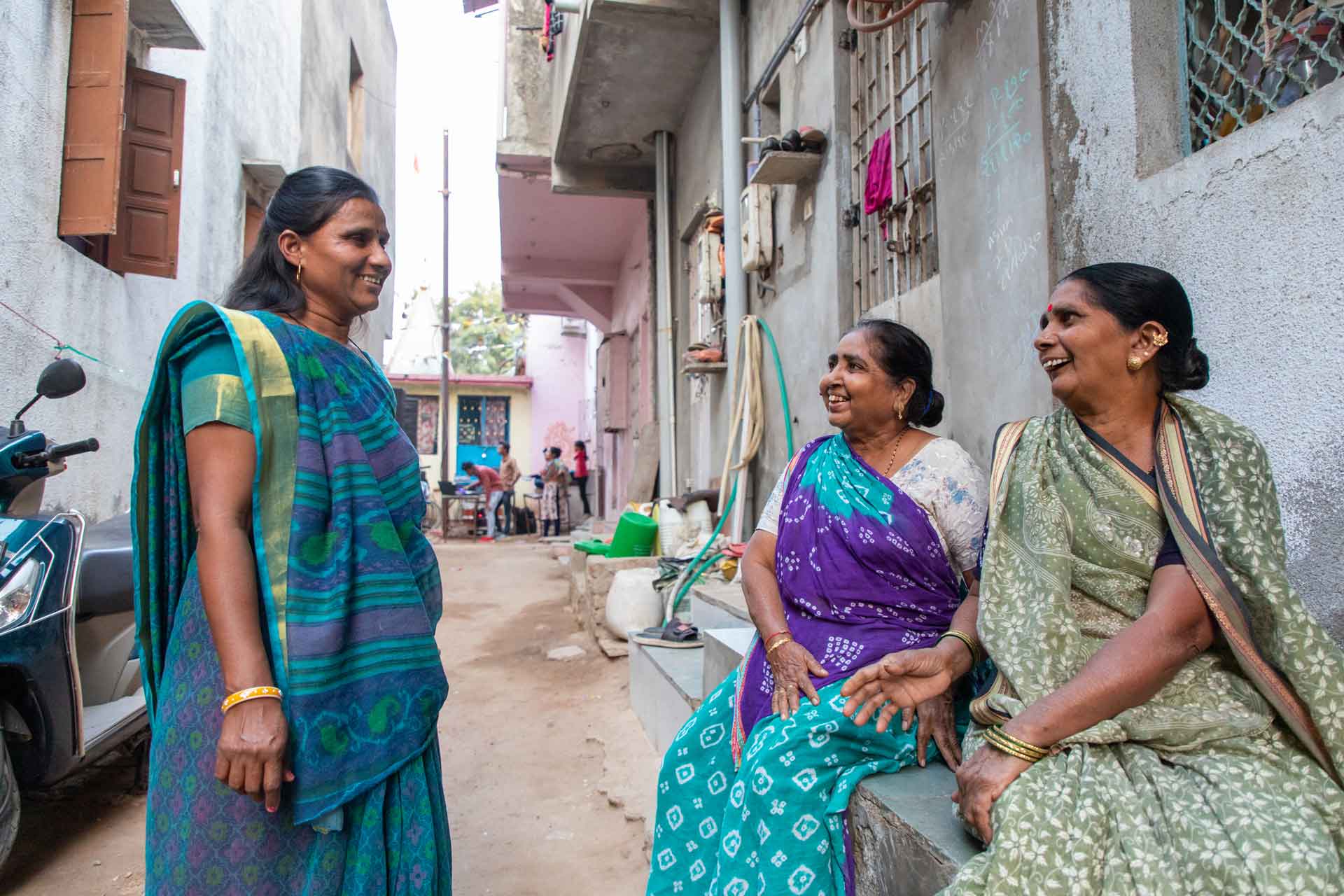
The Mahila Housing Trust (MHT) is empowering women in slum communities to be climate champions for themselves and their cities. Slum dwellers the world over face increased exposure to the effects of climate change, but women in particular are often at the front lines, given their high likelihood to work from home. MHT formed a partnership with the local municipal government in Ahmedabad and technical experts to develop low-cost, effective solutions. Building on local women’s deep knowledge, this partnership trains champions to implement pro‐poor solutions and has influenced Ahmedabad and other cities’ wider climate action planning.
In the last decade, climate resilience has emerged as a major issue in Ahmedabad, as increasing urbanization intersects with heat extremes, water scarcity, flooding, vector-borne diseases and other negative climatic changes. Those living in informal settlements suffer most because they often reside in lower-lying, flood-prone areas and in homes that trap heat and have less resilience to flooding. Disruptions can force residents to reduce working hours to remove water or care for themselves or others after falling sick from heat stroke, dengue and other vector-borne diseases. Women are particularly affected since their livelihoods are more dependent on work done in their homes.
In 2010, a deadly heat wave claimed more than 1,300 lives in one month, serving as a wake-up call for the city. The Ahmedabad Municipal Corporation (AMC) prepared its first Heat Action Plan in 2013, building on a track record of successive urban development and slum upgrading programs. MHT had worked alongside the AMC for more than 20 years on slum housing and water and sanitation infrastructure to bring the benefits of urban development within reach of more residents. In 2014, MHT decided to more consciously incorporate a climate resilience perspective into its work.
MHT quickly understood that many climate-resilient solutions already existed. However, there was a gap between the solutions on offer and the specific needs of slum communities. MHT began forming partnerships with technical institutions and innovators, leveraging its networks and reputation among slum communities and AMC officials, to improve understanding of the challenges faced by residents and the co-creation of viable solutions.
In 2015, MHT began piloting its partnership model, with designated local women leaders called Vikasinis taking the lead in organizing focus group discussions with residents. Together the Vikasinis and residents identified extreme heat, flooding, water scarcity and vector-borne diseases to be the major climate risks affecting their communities. MHT then held a variety of stakeholder and coalition building workshops with technical experts and local leaders to develop actionable solutions.
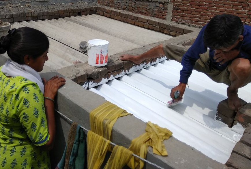
Women’s Action Towards Climate Resilience for the Urban Poor officially launched the following February. MHT organized climate trainings for Vikasinis and gathered their feedback, building it into their evolving model for working with communities. MHT set up community-based monitoring stations and began field-testing solutions. Young people from the neighborhoods were recruited to help collect data. Solutions included household-level interventions such as white paints to reflect the sun off rooftops and reduce temperatures within homes, and sprinkler taps which allow residents greater control of their water use, as well as community-level interventions like water meters, which allow community members to track their water use. Field demonstrations helped validate and finetune these solutions. They also helped the community understand them and encouraged households to make resilient investments.
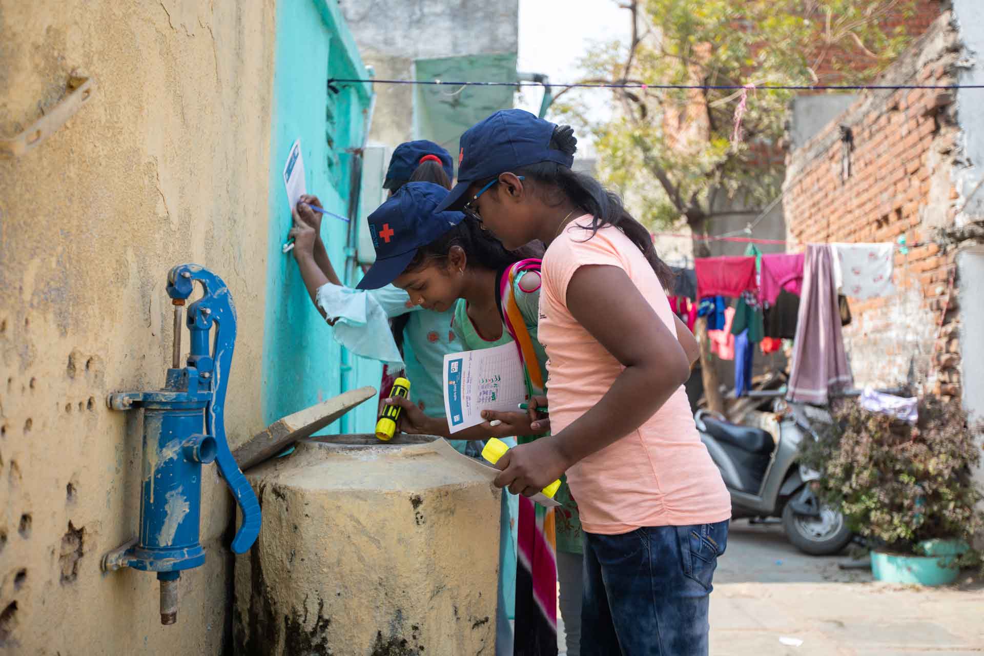
After training women for almost a year, MHT started a climate surveillance system, setting up monitoring stations and training children to collect data on larvae breeding spots. The drive was hugely successful in deepening community awareness of climate risks and motivating behavior change. MHT added an additional campaign for water quality testing in early 2017, which led many families to invest in water purifiers. Using evidence from these drives, communities sent requests to the AMC to clear drains, pave streets, connect water and sewer lines, and install streetlights. Communities also acted on their own, organizing waste collection campaigns and planting trees.
Meanwhile, MHT encouraged families to make climate-resilient investments by demonstrating cool roofing solutions, such as white paints and thermocol roofs, as well as sprinkler taps, rainwater harvesting systems and mosquito nets. The cool roofing solutions garnered particular interest from the AMC Health Department, and MHT was brought in to share knowledge for the development of the city’s 2017 Heat Action Plan.
Due to MHT’s longstanding collaboration with the AMC, they have also been able to put community climate resilience on the broader municipal agenda. MHT and the Vikasinis inputted directly in the 2017 Ahmedabad Heat Action and the 2019 Monsoon Action Plans from the city. The model has scaled beyond Ahmedabad as well, reaching over 125,000 people from 107 slums across six other South Asian cities, including Bhopal, Bhubaneswar, Jaipur, Ranchi, Dhaka, and Kathmandu.
By The Numbers
5 million people benefit from Ahmedabad Heat Action Plan
50,000 people impacted by Monsoon Action Plan
125,000 people benefit across 107 slums in 7 South Asian cities
17,000 cool roofs for affordable housing units
3,338 families received microloans to invest in home climate solutions
2020-2021 SUBMISSIONS
262 SUBMISSIONS 160 CITIES 54 COUNTRIES 6 LANGUAGES
Location
Nairobi, Kenya
THE PROBLEM
Poor drainage and sanitation infrastructure, and precarious housing make the residents of Kibera, one of the world’s largest informal settlements, vulnerable to extreme flooding.
The Big Idea
Develop a network of community-designed and managed public spaces where flood protection and green and grey infrastructure are layered with core services and amenities.
Life Changing Impact
Significantly improved service access and flood protection for over 125,000 residents, benefiting women and young people in particular.
Ripple Effect
Influencing the uptake of new climate, water and sanitation initiatives across Nairobi, and inspired a new approach to upgrading informal settlements that prioritizes community-level knowledge and perspectives.
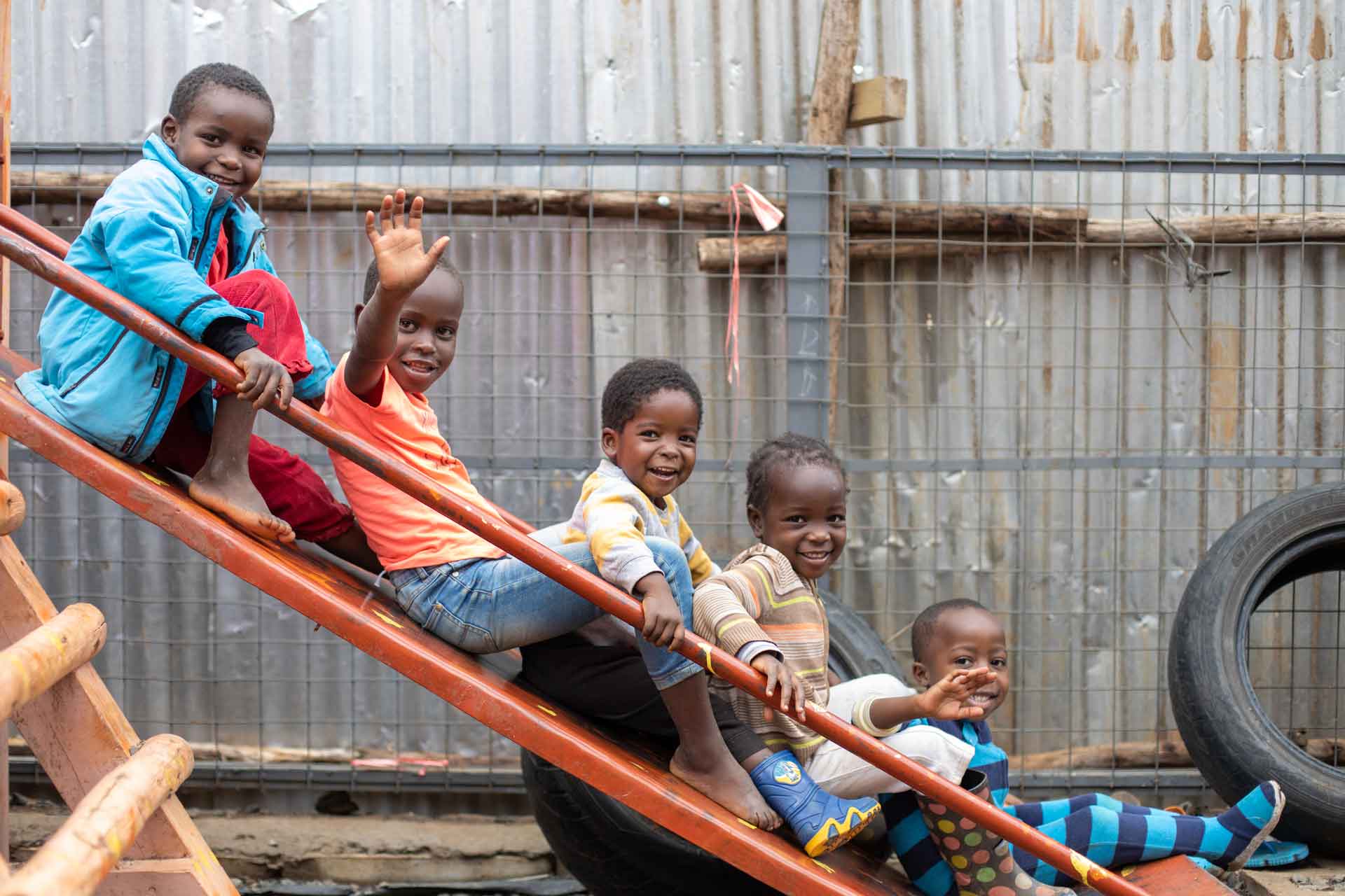
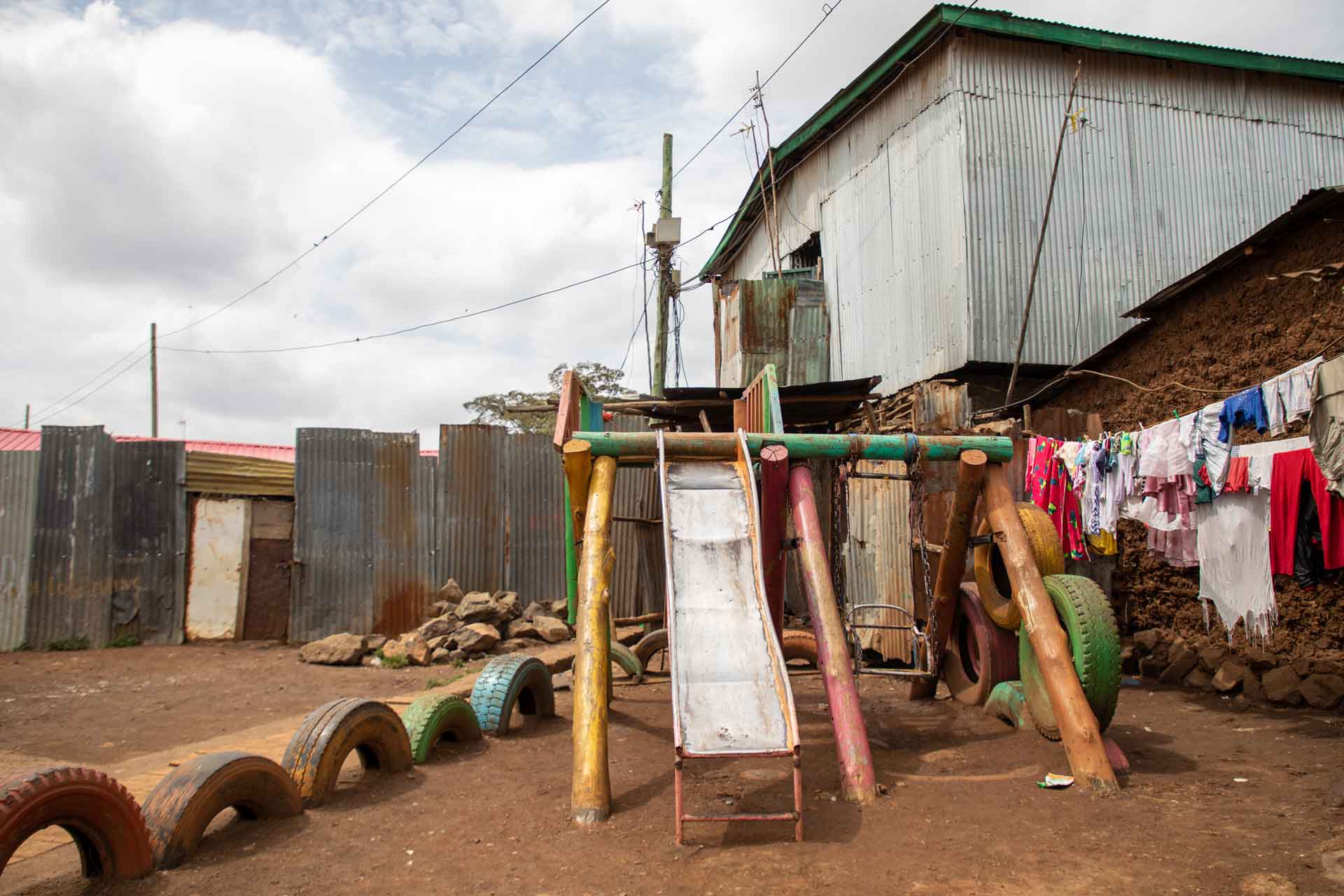
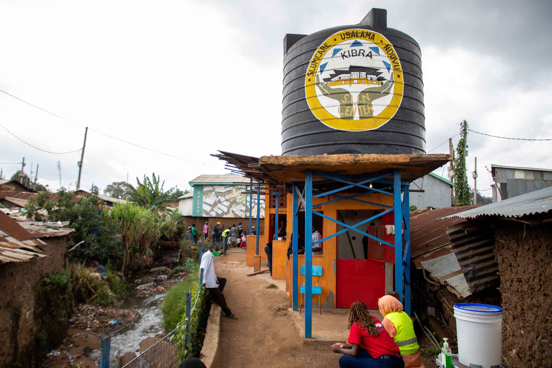
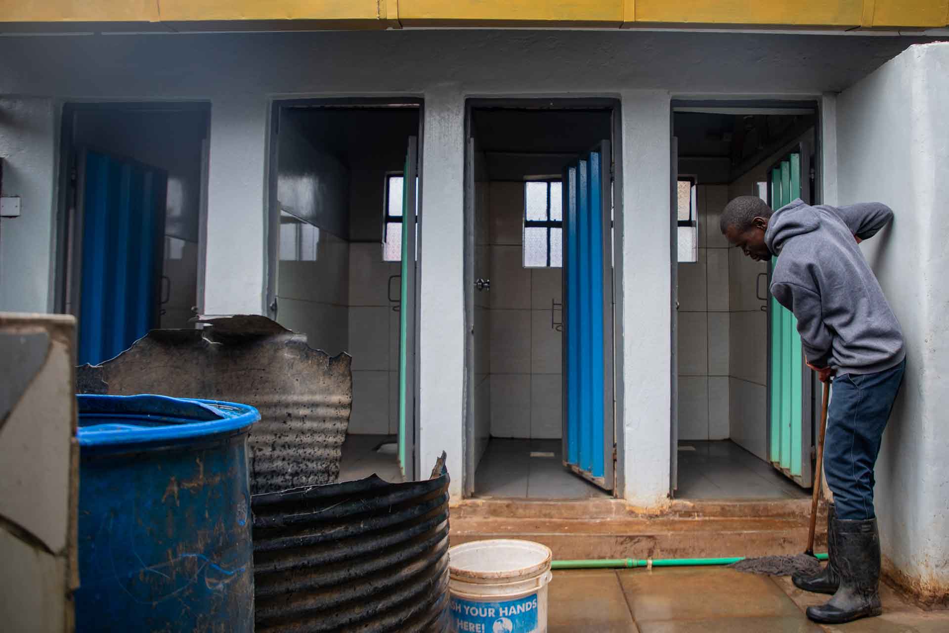
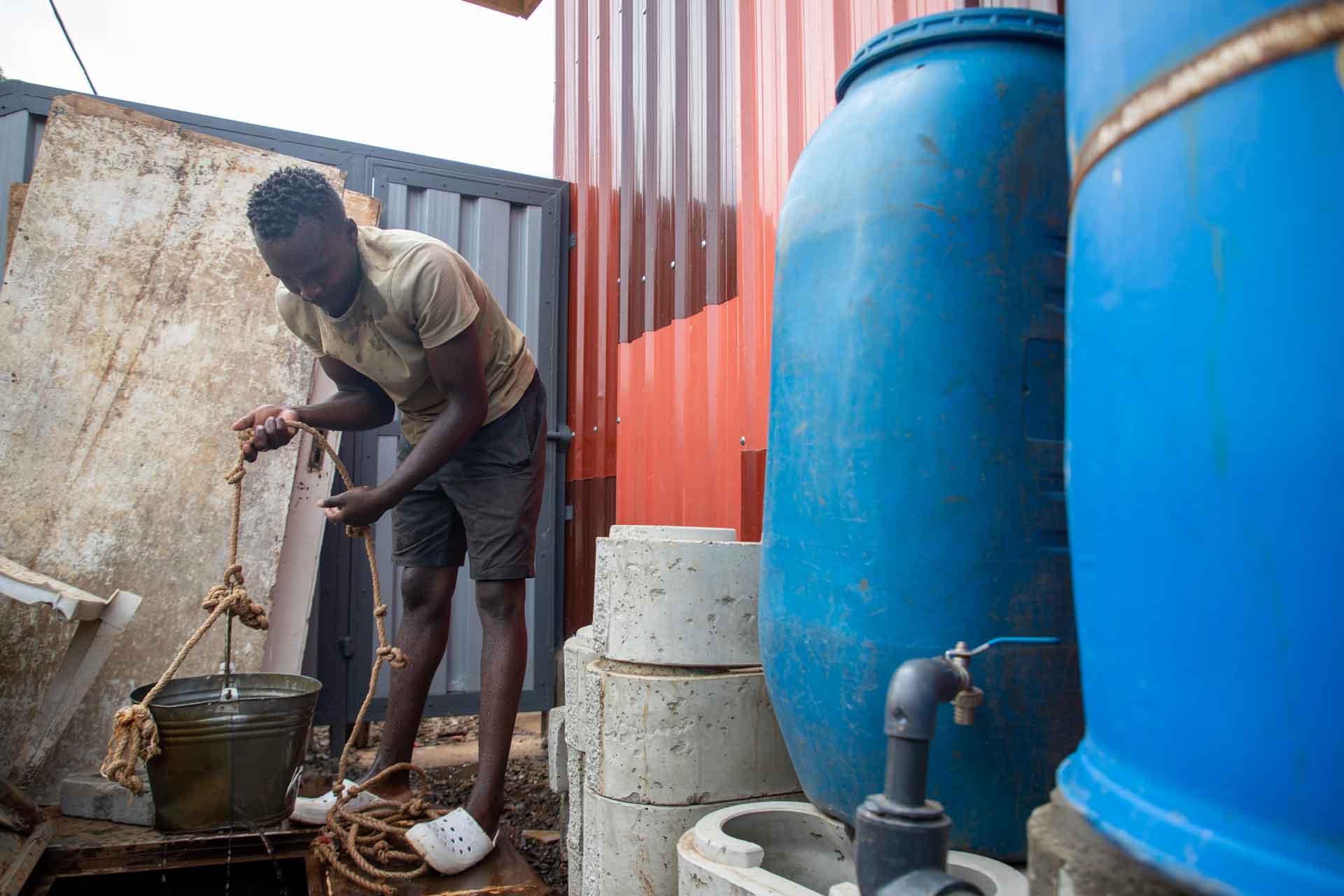
Kounkuey Design Initiative (KDI) is improving quality of life in one of the world’s largest informal settlements through the Kibera Public Space Project, a network of community-managed public spaces that reduce flood risk while providing access to core services and creating new business opportunities. Each space created by KDI is designed to meet the specific needs of residents and combines river remediation and sustainable drainage infrastructure with community buildings, space for small businesses and recreation, and sanitation and laundry facilities.
Located in the center of Nairobi and home to over 300,000 people, Kibera has long been a neighborhood of interest for both national and international development efforts. While Kibera experiences many issues common to urban informal settlements, such as precarious housing, political conflict and limited public space, its position along the Ngong River and poor drainage and sanitation infrastructure make it highly vulnerable to flooding as well.
Recognizing the challenges faced in Kibera, as well as the need for a new model of development, KDI began working with the New Nairobi Dam Community Group in 2006 to co-design their first public space in the neighborhood. The name Kounkuey means “to get to know something intimately” and embodies the organization’s deeply participatory approach to working with the community. In contrast to the “raze and replace” model traditionally used to build infrastructure in informal settlements across the world, KDI’s model combines access to drainage, sewerage and public space without removing existing housing by remediating polluted land and clearing dumpsites.
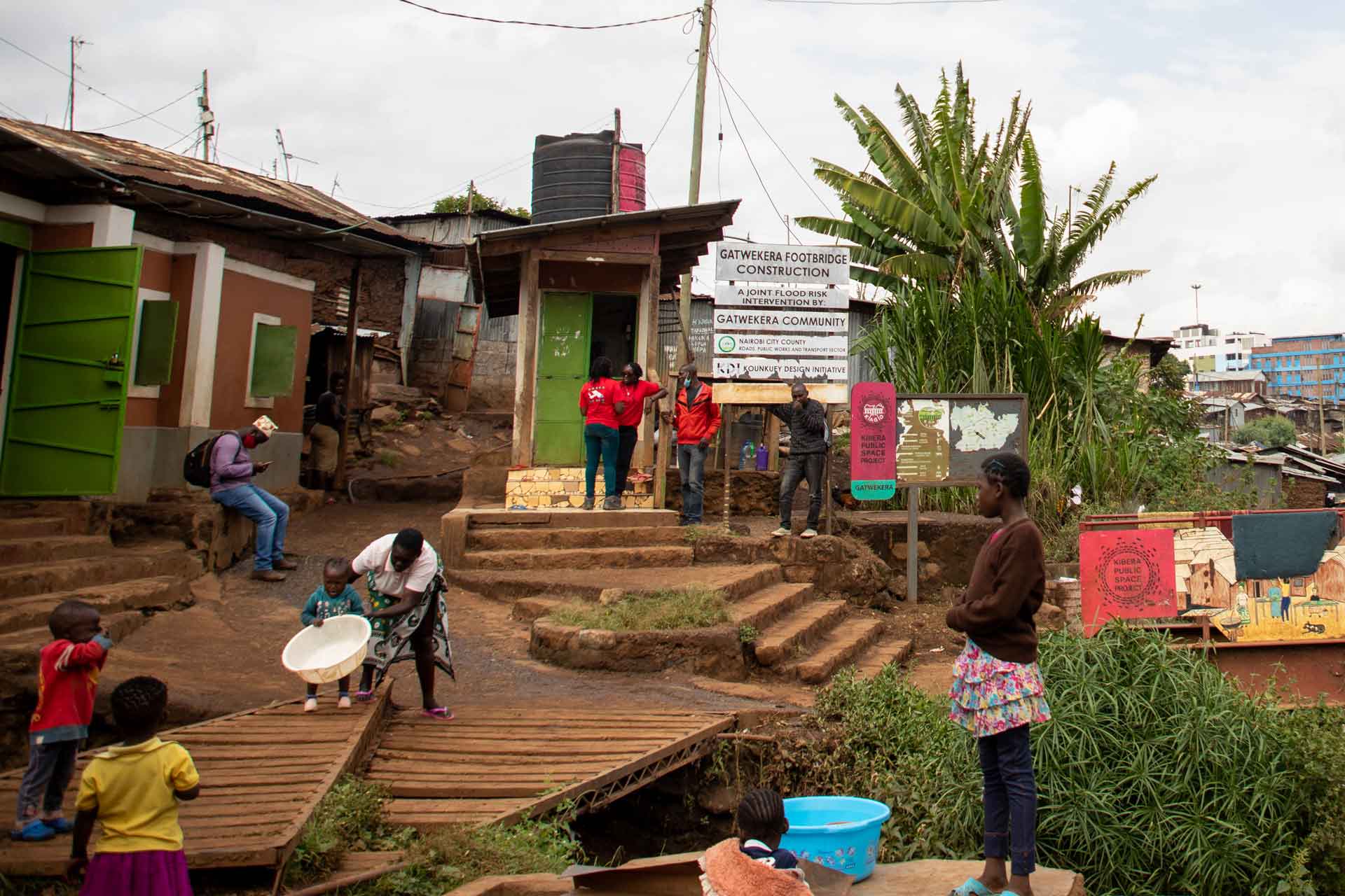
Given the Kibera residents’ long and often contentious relationship with the government – residents do not own the land they live on in many cases, and some have been forcibly evicted – building trust with local residents has been critical. In 2011, KDI began using a request for proposal process to establish transparent partnerships with community-based organizations. Together, KDI and at least one community-based organization determine the most pressing needs of residents in an area and design a new public space together. Every KDI site integrates multiple key services through multifunctional buildings and amenities. For instance, the community hall in one site serves as a gathering space, school and place of worship, but is designed so that its rooftop captures rainwater, reducing flood risk and irrigating a connected greenhouse. KDI also centers the voices of women and children in the design process to create solutions such as adjacent laundry pads and play areas, which allow mothers to balance housework and childcare.
KDI provides technical and financial capacity, analyzing sites and determining what type of infrastructure can be installed. The community-based organizations share responsibility for construction and management of sites. This model allows residents to build capacity as well as establish ownership of their new resource. KDI also provides training for local residents to open small businesses and run income-generating programs at each site, helping to ensure that the public spaces are self-sustaining and vibrant community hubs, and providing a new source of livelihood for many of the neighborhood’s young adults who typically face high unemployment rates.
Since the first KDI site was opened in 2010, the organization has built 10 additional public spaces with community partners. The project’s deep network of community expertise and leadership brings flexibility and resilience. In 2015, for example, when a new municipal sewer line was being installed, one fully built and operational site had to be almost entirely taken down by the community to make way. However, other community-based organizations were able to negotiate connecting the line to their KDI sites, gaining access to formal sewerage in two additional locations across Kibera. These connections, as well as the toilet blocks installed in other sites, reduce sewerage going into the Ngong River, a main source of pollution in Nairobi’s watershed.
KDI has gained trust and a reputation for delivery that they leveraged in negotiations with the local and national government, helping to connect the knowledge and insights of informal residents to official policymaking processes. In 2016, KDI signed a memorandum of understanding with the County Department of Public Works to address flood risks in hotspots along the Ngong River using data from nearly 1,000 households and community groups. In 2018, KDI began working with the Kenya Meteorological Department to make climate and weather information more accessible to residents of Kibera as well as other informal settlements in Nairobi.
After two years of lobbying by KDI and Slum/Shack Dwellers International, the Nairobi Metropolitan Services approved the Kibera Special Planning Area in 2020, creating a formal opportunity to reshape the city’s approach to development and better incorporate the perspectives of residents.
By The Numbers
11 new climate-resilient public spaces
35% of all purpose-built
public space in Kibera
5,000+ residents involved in design
520 meters of flood protection installed
840 meters of drainage infrastructure installed
Network services 10,000 people/day